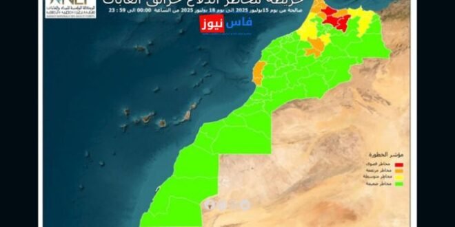
The National Water and Forests Agency announced that it will release, between July 15 and 18, scientifically based predictive maps that accurately identify sensitive areas at risk of forest fires nationwide. This initiative aims to anticipate and prevent forest fire outbreaks across the country. According to the agency’s statement, these maps were developed following a comprehensive analysis of data related